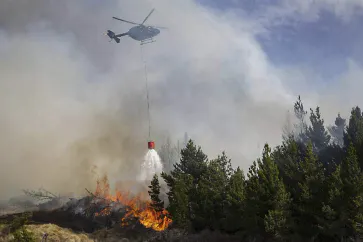
Case Study: Catching Fire – Aerial Fire Mapping
Wildfires are a permanent threat for several regions around the world – and the global climate change is adding to the number and severity of these events. Fighting them is a huge challenge, strong winds, heat and inaccessibility make it even more difficult and dangerous for those who risk their life to protect others. One approach to tackle wildfires is the usage of airborne fire mapping. Highland Helicopters is a service company which added this task to their portfolio, as wildfires on New Zealand´s South Island happened right at their front door. On board is the VarioCAM® HD head 800 from InfraTec.
The public perception of devastating wildfires in the Northern Hemisphere is typically allocated to disastrous events happening in California or the Mediterranean region and in the Southern Hemisphere in Australia. Some regions in neighbouring New Zealand, however, are suffering from burning forests, fields and bushes as well.
Fire mapping from a helicopter offers a unique elevated perspective on remote fires to those who have to direct firefighting ground activities. The (1,024 × 768) pixels LWIR thermal camera VarioCAM® HD can detect through smoke and dust that block video camera views in the visual spectral range – this is a great benefit for on-site situational awareness. When this camera is radiometrically calibrated it also creates the opportunity to indicate actual fire and ground temperatures. Additional support for active firefighting can be given to ground staff and waterbombing aircraft, as VarioCAM® HD capabilities clearly traces the water ground tracks to assist the involved pilots.
Read case study about aerial fire mapping